Biological Oceanographer: plankton net
-Modification on the standard trawl used to collect planktonicorganisms, of nearly any size, intact. Towed by a research vessel, Plankton Nets have a long funnel shape that allows them to catch differently sized plankton simply by changing the mesh size of the net. At the end of the funnel is a collection cylinder called a cod-end.

Chemical Oceanographer: Nansen bottle
-The bottle, more precisely a metal or plastic cylinder, is lowered on a cable into the ocean, and when it has reached the required depth, a brass weight called a "messenger" is dropped down the cable. When the weight reaches the bottle, the impact tips the bottle upside down and trips a spring-loaded valve at the end, trapping the water sample inside. The bottle and sample are then retrieved by hauling in the cable.
A second messenger can be arranged to be released by the inverting mechanism, and slide down the cable until it reaches another Nansen bottle. By fixing a sequence of bottles and messengers at intervals along the cable, a series of samples at increasing depth can be taken.

Physical Oceanographer: current meter
-Current meters are usually deployed within an oceanographic mooring consisting of an anchor weight on the ground, a mooring line with the instrument(s) connected to it and a floating device to keep the mooring line more or less vertical. Like a kite in the wind, the actual shape of the mooring line will not be completely straight, but following a so-called (half-)catenary. Under the influence of water currents (and wind if the top buoy is above the sea surface) the shape of the mooring line can be determined and by this the actual depth of the instruments.

Geological Oceanographer: bathymetric maps
-Scientists studying the seafloor often use bathymetric maps like the one below. These maps use color to indicate water depth. On most bathymetric images of the ocean, colors on the “warm” end of the spectrum – red, orange, and yellow - represent shallower water. As the water deepens, the colors shift through green, blue, and finally into violet. Dry land is usually shown in white. All areas of the seafloor that are the same distance below the surface will be shown in the same color. When the color changes, so does the depth. In this way, 3-dimensional topography is shown on a 2-dimensional map. Once you become accustomed to the relationship between color and depth on bathymetric images, you will be able to see shapes and structures on the ocean bottom.

Geophysical Oceanographer: drilling ship
-A drillship is a maritime vessel that has been fitted with drilling apparatus. It is most often used for exploratory offshore drilling of new oil or gas wells in deep water or for scientific drilling. The drillship can also be used as a platform to carry out well maintenance or completion work such as casing and tubing installation or subsea tree installations. It is often built to the design specification of the oil production company and/or investors, but can also be a modified tanker hull outfitted with a dynamic positioning system to maintain its position over the well.
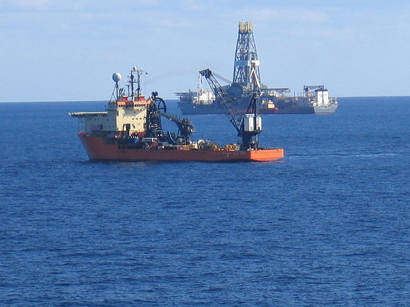
The greatest advantages these modern drillships have is their ability to drill in water depths of more than 2500 m and the time saved sailing between oilfields worldwide. Drillships are completely independent, in contrast to semi-submersibles and jackup barges. In order to drill, a marine riser is lowered from the drillship to the seabed with a blowout preventer (BOP) at the bottom that connects to the wellhead. Drillships are just one way to perform exploratory drilling. This function can also be performed by semi-submersibles, jackup barges, barges, or platform rigs.
No comments:
Post a Comment